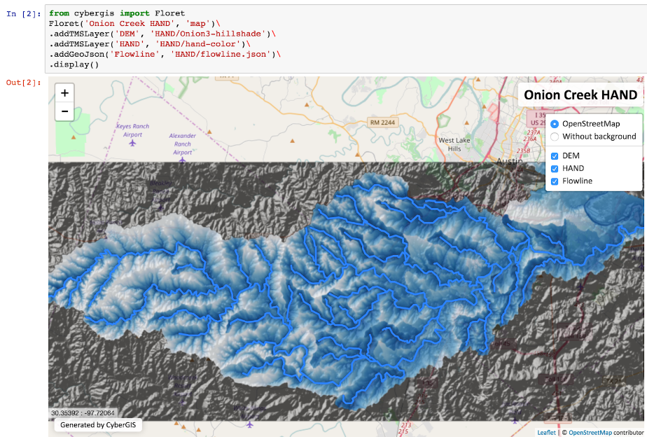
CyberGIS-Jupyter is an innovative cyberGIS framework for achieving data-intensive, reproducible, and scalable geospatial analytics using Jupyter Notebook. The framework adapts the Notebook with built-in cyberGIS capabilities to accelerate gateway application development and sharing while associated data, analytics, and workflow runtime environments are encapsulated into application packages that can be elastically reproduced through cloud computing approaches. As a desirable outcome, data-intensive and scalable geospatial analytics can be efficiently developed and improved, and seamlessly reproduced among multidisciplinary users in a novel cyberGIS science gateway environment.
Grant Numbers: NSF (1047916, 1443080, 1551492, 16644119, 1229699)
People: Dandong Yin (dyin4@illinois.edu), Fangzheng Lyu(flu8@illinois.edu), Shaowen Wang (shaowen@illinois.edu)
Publications:
- Yin, D., Liu, Y., Padmanabhan, A., Terstriep, J., Rush, J., & Wang, S. (2017, July). A CyberGIS-Jupyter Framework for Geospatial Analytics at Scale. In Proceedings of the Practice and Experience in Advanced Research Computing 2017 on Sustainability, Success and Impact (p. 18). ACM.
